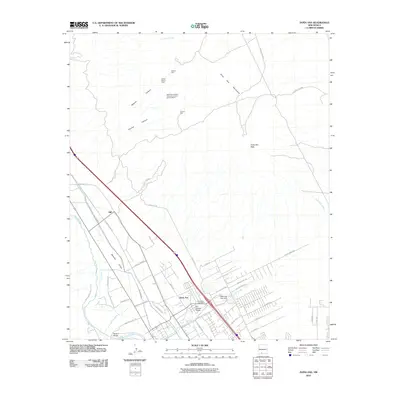
2010 Map of Dona Ana
USGS Topo · Published 2010About this map
The Mesilla Valley dominates the southwestern portion of this landscape, where the Rio Grande is flanked by a complex system of agricultural water management including the Leasburg Canal, Leasburg Drain, and Hill Lateral. The community of Doña Ana serves as the central hub, featuring the Dona Ana Post Office and a network of named roads like El Camino Real and Dona Ana School Rd. Moving northeast, the terrain rises sharply into the Doña Ana Mountains, anchored by the prominent Doña Ana Peak. This area reveals a transition from irrigated valley farming to arid ranching and mining history, evidenced by the New Mexico State University Animal Science Ranch and the Piedra Blanca Claim. Several arroyos, such as Lucero Arroyo and Doña Ana Arroyo, drain the mountain slopes toward the river, while landmarks like Shalem Bridge and Wagner Well mark essential water points for local travelers and residents.
Find a feature on this map
56 named features on this map. Tap any name to fly to it.
Don’t see what you’re looking for? This feature index may not catch every label — zoom into the map to look around manually.
Map Details
Editions of this 2010 Dona Ana Map
This is the sole edition of this map. No revisions or reprints were ever made.
Other maps of this area

1891 · Las Cruces
USGS Topo · 1:125,000

1893 · Las Cruces
USGS Topo · 1:125,000

1916 · Tonuco
USGS Topo · 1:125,000

1932 · Tonuco
USGS Topo · 1:125,000

1941 · Las Cruces
USGS Topo · 1:62,500

1941 · Organ Peak
USGS Topo · 1:62,500

1943 · Organ Peak
USGS Topo · 1:62,500

1943 · Las Cruces
USGS Topo · 1:62,500

1948 · Bear Peak
USGS Topo · 1:62,500

1948 · San Diego Mountain
USGS Topo · 1:62,500