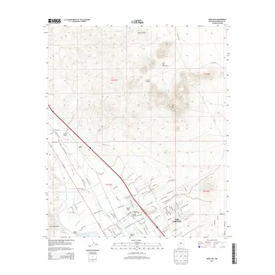
2013 Map of Dona Ana
USGS Topo · Published 2013About this map
The Mesilla Valley defines the western half of this landscape, where the Rio Grande creates a lush agricultural corridor contrasted against the high desert. This 2013 survey details a sophisticated network of irrigation and drainage infrastructure essential to the region's farming, including the Leasburg Canal, Shalem Drain, and Picacho Canal. The settlement of Doña Ana sits at the heart of this system, with its post office and the Rio Grande Bridge serving as vital community anchors. To the east, the terrain rises sharply into the Doña Ana Mountains, dominated by Dona Ana Peak and cut by deep drainages like Wagner Canyon and Cleofas Canyon. The map provides a look at the suburban expansion of Las Cruces as it reaches toward these foothills, showing a complex grid of residential streets such as Dona Villa Dr and Shenandoah Trl emerging near the older valley floor.
Find a feature on this map
95 named features on this map. Tap any name to fly to it.
Don’t see what you’re looking for? This feature index may not catch every label — zoom into the map to look around manually.
Map Details
Editions of this 2013 Dona Ana Map
This is the sole edition of this map. No revisions or reprints were ever made.
Other maps of this area

1891 · Las Cruces
USGS Topo · 1:125,000

1893 · Las Cruces
USGS Topo · 1:125,000

1916 · Tonuco
USGS Topo · 1:125,000

1932 · Tonuco
USGS Topo · 1:125,000

1941 · Las Cruces
USGS Topo · 1:62,500

1941 · Organ Peak
USGS Topo · 1:62,500

1943 · Organ Peak
USGS Topo · 1:62,500

1943 · Las Cruces
USGS Topo · 1:62,500

1948 · Bear Peak
USGS Topo · 1:62,500

1948 · San Diego Mountain
USGS Topo · 1:62,500