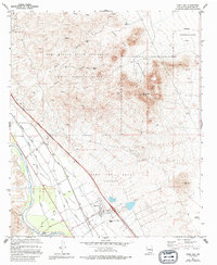
1978 Map of Dona Ana
USGS Topo · Published 1994About this map
The Doña Ana Bend Colony and the historic community of Doña Ana anchor this landscape along the fertile reach of the Mesilla Valley. In the mid-1970s, the area's agricultural identity is clearly defined by an intricate network of irrigation features, including the Leasburg Canal, Shalem Canal, and several drainage systems like Hill Drain and Picacho Drain that manage the waters of the Rio Grande.
Find a feature on this map
31 named features on this map. Tap any name to fly to it.
Don’t see what you’re looking for? This feature index may not catch every label — zoom into the map to look around manually.
Map Details
Editions of this 1978 Dona Ana Map
This is the sole edition of this map. No revisions or reprints were ever made.
Other maps of this area

1891 · Las Cruces
USGS Topo · 1:125,000

1893 · Las Cruces
USGS Topo · 1:125,000

1916 · Tonuco
USGS Topo · 1:125,000

1932 · Tonuco
USGS Topo · 1:125,000

1941 · Las Cruces
USGS Topo · 1:62,500

1941 · Organ Peak
USGS Topo · 1:62,500

1943 · Organ Peak
USGS Topo · 1:62,500

1943 · Las Cruces
USGS Topo · 1:62,500

1948 · Bear Peak
USGS Topo · 1:62,500

1948 · San Diego Mountain
USGS Topo · 1:62,500