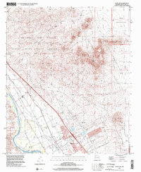
1996 Map of Dona Ana
USGS Topo · Published 2002About this map
Dona Ana sits at the base of the Dona Ana Mountains in this survey reflecting the agricultural and research-oriented character of the region in the late 1990s. The landscape is defined by the sharp transition from the elevated desert terrain of Dona Ana Peak to the irrigated fertile grounds of the Mesilla Valley. Water management is central to the area's layout, evidenced by the extensive network of the Leasburg Canal, Shalem Canal, and the Rio Grande. Large tracts of land are dedicated to the New Mexico State University Chihuahua Desert Rangeland Research Center and the Jornada Experimental Range, underscoring the long-standing importance of range science in this part of New Mexico. The Dona Ana Bend Colony boundary encompasses the older settlement patterns and a local Cemetery, while various prospects and a quarry hint at the area's mineral interest.
Find a feature on this map
30 named features on this map. Tap any name to fly to it.
Don’t see what you’re looking for? This feature index may not catch every label — zoom into the map to look around manually.
Map Details
Editions of this 1996 Dona Ana Map
This is the sole edition of this map. No revisions or reprints were ever made.
Other maps of this area

1891 · Las Cruces
USGS Topo · 1:125,000

1893 · Las Cruces
USGS Topo · 1:125,000

1916 · Tonuco
USGS Topo · 1:125,000

1932 · Tonuco
USGS Topo · 1:125,000

1941 · Las Cruces
USGS Topo · 1:62,500

1941 · Organ Peak
USGS Topo · 1:62,500

1943 · Organ Peak
USGS Topo · 1:62,500

1943 · Las Cruces
USGS Topo · 1:62,500

1948 · Bear Peak
USGS Topo · 1:62,500

1948 · San Diego Mountain
USGS Topo · 1:62,500