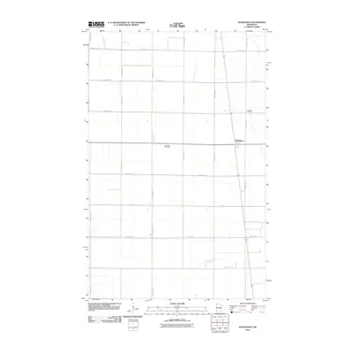
2010 Map of Donaldson
USGS Topo · Published 2010About this map
The small town of Donaldson serves as the focal point for this section of Kittson County, defined by a rigid grid of agricultural roads and section lines. The Donaldson Post Office and nearby Hillcrest Cemetery provide essential touchstones for local history and genealogical research in this northern Minnesota prairie landscape. The area is heavily intersected by a network of township and county routes, including County Hwy-81, Csah 18, and 450th St NW, which facilitate the movement of goods and people across the flat, open terrain. This survey reflects the persistence of rural settlements and the infrastructure required to maintain connectivity in the sparsely populated Red River Valley region during the early 21st century.
Find a feature on this map
25 named features on this map. Tap any name to fly to it.
Don’t see what you’re looking for? This feature index may not catch every label — zoom into the map to look around manually.
Map Details
Editions of this 2010 Donaldson Map
This is the sole edition of this map. No revisions or reprints were ever made.
Other maps of this area

1918 · Acton
USGS Topo · 1:62,500

1918 · Argyle
USGS Topo · 1:62,500

1939 · Drayton
USGS Topo · 1:62,500

1939 · Kennedy
USGS Topo · 1:62,500

1941 · Kennedy
USGS Topo · 1:62,500

1941 · Drayton
USGS Topo · 1:62,500

1952 · Thief River Falls
USGS Topo · 1:250,000

1954 · Stephen
USGS Topo · 1:62,500

1956 · Thief River Falls
USGS Topo · 1:250,000

1957 · Thief River Falls
USGS Topo · 1:250,000