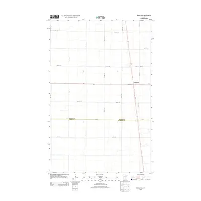
2013 Map of Donaldson
USGS Topo · Published 2013About this map
Donaldson occupies the center of this 2013 survey of the northwestern Minnesota prairie, where the section-line grid of the Red River Valley meets the transportation corridors of Us-75 and Mn-11. The map documents a landscape defined by industrial agriculture and straight-line roads, such as Commercial St and 1st St, which form the small town's core. Just north of the village, Hillcrest Cem serves as a local landmark for genealogical research. The southern portion of the sheet is marked by the jurisdictional boundary between Kittson Co and Marshall Co, running along Csah 18. This transition from township roads like TWP HWY T-144 to county highways illustrates the organized settlement pattern of this rural region, anchored by the local Po at the crossroads of regional commerce.
Find a feature on this map
27 named features on this map. Tap any name to fly to it.
Don’t see what you’re looking for? This feature index may not catch every label — zoom into the map to look around manually.
Map Details
Editions of this 2013 Donaldson Map
This is the sole edition of this map. No revisions or reprints were ever made.
Other maps of this area

1918 · Acton
USGS Topo · 1:62,500

1918 · Argyle
USGS Topo · 1:62,500

1939 · Drayton
USGS Topo · 1:62,500

1939 · Kennedy
USGS Topo · 1:62,500

1941 · Kennedy
USGS Topo · 1:62,500

1941 · Drayton
USGS Topo · 1:62,500

1952 · Thief River Falls
USGS Topo · 1:250,000

1954 · Stephen
USGS Topo · 1:62,500

1956 · Thief River Falls
USGS Topo · 1:250,000

1957 · Thief River Falls
USGS Topo · 1:250,000