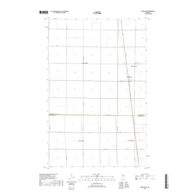
2019 Map of Donaldson
USGS Topo · Published 2019About this map
Donaldson sits at the heart of this prairie landscape, where the township boundaries of t159n r48w and t159n r49w meet. The 2019 survey documents a highly organized grid of rural roads and county routes that define the Red River Valley’s agricultural character. A significant jurisdictional boundary is marked by the Kittson Co Marshall Co line, which follows the path of Co St Aid Hwy 18. Local history and genealogy are anchored by the Hillcrest Cem north of the main settlement. The town itself is centered on the intersection of Commercial St and 1st St, serving as a vital hub for the surrounding townships. The drainage and terrain are captured through the lens of modern hydrography and elevation datasets, showing the flat, open expanse of northwestern Minnesota near the turn of the decade.
Find a feature on this map
23 named features on this map. Tap any name to fly to it.
Don’t see what you’re looking for? This feature index may not catch every label — zoom into the map to look around manually.
Map Details
Editions of this 2019 Donaldson Map
This is the sole edition of this map. No revisions or reprints were ever made.
Other maps of this area

1918 · Acton
USGS Topo · 1:62,500

1918 · Argyle
USGS Topo · 1:62,500

1939 · Drayton
USGS Topo · 1:62,500

1939 · Kennedy
USGS Topo · 1:62,500

1941 · Kennedy
USGS Topo · 1:62,500

1941 · Drayton
USGS Topo · 1:62,500

1952 · Thief River Falls
USGS Topo · 1:250,000

1954 · Stephen
USGS Topo · 1:62,500

1956 · Thief River Falls
USGS Topo · 1:250,000

1957 · Thief River Falls
USGS Topo · 1:250,000