2022 Map of Donaldson
USGS Topo · Published 2022About this map
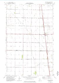
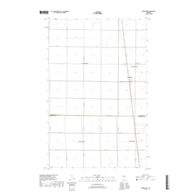
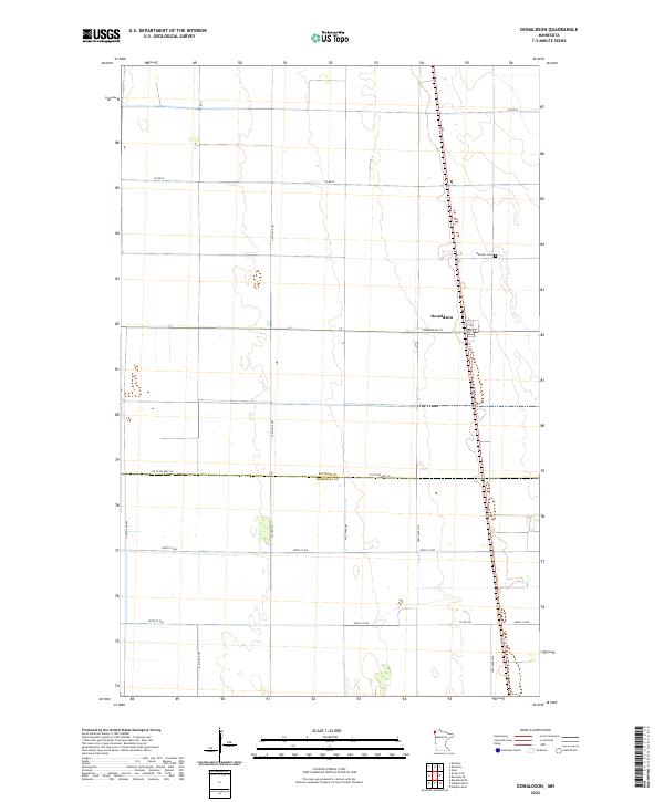
The small settlement of Donaldson sits at the intersection of Commercial St and 1st St in this northern Minnesota landscape. This 2022 survey illustrates the grid-based agricultural organization of the Red River Valley region, where the border between Kittson County and Marshall County is clearly defined by the path of Co St Aid Hwy 18. To the north of the town center, Hillcrest Cem serves as a significant landmark for genealogical research. The map captures a highly structured transportation network dominated by county routes like Co Rd 23 and Co Hwy 22, which facilitate movement through the surrounding sections of the Public Land Survey System. The rectilinear road patterns and isolated township boundaries reflect a modern era of large-scale farming and rural connectivity.
Find a feature on this map
23 named features on this map. Tap any name to fly to it.
Don’t see what you’re looking for? This feature index may not catch every label — zoom into the map to look around manually.
Map Details
Editions of this 2022 Donaldson Map
This is the sole edition of this map. No revisions or reprints were ever made.
Historical Maps of Donaldson Through Time
6 maps found