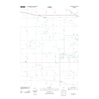
2013 Map of Donaldson
USGS Topo · Published 2013About this map
Agricultural lands and water management systems define this Marshall County landscape centered on the settlement of Donaldson. The area's legacy of drainage and irrigation is visible through an extensive network of waterways, including Morse Ditch, Blad Ditch, and the Yellow River which winds through the southern portion of the quadrangle. Local industry and land use are specifically noted through agricultural landmarks such as the Wolff Livestock Farm, Circle L Ranch, and J M J Dairy Farm.
Find a feature on this map
93 named features on this map. Tap any name to fly to it.
Don’t see what you’re looking for? This feature index may not catch every label — zoom into the map to look around manually.
Map Details
Editions of this 2013 Donaldson Map
This is the sole edition of this map. No revisions or reprints were ever made.
Other maps of this area

1953 · Chicago
USGS Topo · 1:250,000

1957 · Chicago
USGS Topo · 1:250,000

1957 · Knox East
USGS Topo · 1:24,000

1957 · Plymouth
USGS Topo · 1:24,000

1958 · Donaldson
USGS Topo · 1:24,000

1958 · La Paz
USGS Topo · 1:24,000

1958 · Hamlet
USGS Topo · 1:24,000

1958 · Walkerton
USGS Topo · 1:24,000

1962 · Bass Lake
USGS Topo · 1:24,000

1962 · Culver
USGS Topo · 1:24,000