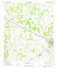
1974 Map of Donalsonville West
USGS Topo · Published 1976About this map
The Seaboard Coast Line railroad dictates the industrial alignment of southwest Georgia in the mid-1970s, cutting a diagonal path through the agricultural heart of Seminole and Early counties. This survey centers on the transition from the Chattahoochee River lowlands to the more established settlements of Jakin and the western edge of Donalsonville. The rural landscape is densely dotted with community cornerstones, specifically a high concentration of small country churches including Midway Ch, Newberry Ch, and St Matthew Ch.
Find a feature on this map
29 named features on this map. Tap any name to fly to it.
Don’t see what you’re looking for? This feature index may not catch every label — zoom into the map to look around manually.
Map Details
Editions of this 1974 Donalsonville West Map
This is the sole edition of this map. No revisions or reprints were ever made.
Other maps of this area

1952 · Bascom
USGS Topo · 1:24,000

1953 · Dothan
USGS Topo · 1:250,000

1954 · Dothan
USGS Topo · 1:250,000

1954 · Steam Mill
USGS Topo · 1:24,000

1954 · Desser
USGS Topo · 1:24,000

1954 · Tallahassee
USGS Topo · 1:250,000

1955 · Dothan
USGS Topo · 1:250,000

1959 · Tallahassee
USGS Topo · 1:250,000

1960 · Tallahassee
USGS Topo · 1:250,000

1970 · Gordon
USGS Topo · 1:24,000