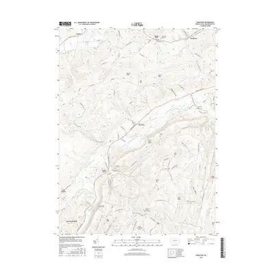
2016 Map of Donation
USGS Topo · Published 2016About this map
Standing Stone Creek meanders through the central valley of this Huntingdon County landscape, separating the prominent heights of Warrior Ridge from the eastern slopes of Stone Creek Ridge. This area is defined by its numerous small burial sites and family plots, such as the Evans Family Cem, Stewart Family Cem, and the Gorsuch Cem, which offer significant value for genealogical research in rural Pennsylvania. Small clusters of settlement like Manor Hill, Donation, and Center Union are connected by a network of local roads such as Standing Stone Rd and Murray Run Rd. The southern edge of the map features the outskirts of Huntingdon and the Agudath Achim Memorial Park. Near the community of Saulsburg, the terrain transitions toward Stillhouse Hollow, while the private Hilling International Airport serves the local aviation needs of this upland region.
Find a feature on this map
97 named features on this map. Tap any name to fly to it.
Don’t see what you’re looking for? This feature index may not catch every label — zoom into the map to look around manually.
Map Details
Editions of this 2016 Donation Map
This is the sole edition of this map. No revisions or reprints were ever made.
Other maps of this area

1901 · Huntingdon
USGS Topo · 1:62,500

1904 · Huntingdon
USGS Topo · 1:62,500

1919 · Menno
USGS Topo · 1:62,500

1922 · Mt Union
USGS Topo · 1:48,000

1923 · Tyrone
USGS Topo · 1:62,500

1924 · Mt. Union
USGS Topo · 1:62,500

1929 · Tyrone
USGS Topo · 1:48,000

1933 · Tyrone
USGS Topo · 1:62,500

1935 · Allensville
USGS Topo · 1:62,500

1938 · Allensville
USGS Topo · 1:62,500