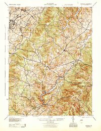
1944 Map of Donegal
USGS Topo · Published 1945About this map
Mount Pleasant and the surrounding townships of Donegal and Bullskin are captured in this mid-century survey, shortly after the construction of the Pennsylvania Turnpike. The landscape is a complex network of rural schoolhouses and small mining or milling settlements such as Mammoth and Calumet. The presence of the Baltimore and Ohio railroad corridor highlights the industrial connectivity of the era, while numerous named schools like Stauffer Sch and Packer Sch indicate a densely settled rural population.
Find a feature on this map
110 named features on this map. Tap any name to fly to it.
Don’t see what you’re looking for? This feature index may not catch every label — zoom into the map to look around manually.
Map Details
Editions of this 1944 Donegal Map
This is the sole edition of this map. No revisions or reprints were ever made.
Other maps of this area

1900 · Uniontown
USGS Topo · 1:62,500

1900 · Latrobe
USGS Topo · 1:62,500

1902 · Latrobe
USGS Topo · 1:62,500

1902 · Connellsville
USGS Topo · 1:62,500

1903 · Latrobe
USGS Topo · 1:62,500

1904 · Greensburg
USGS Topo · 1:62,500

1906 · Greensburg
USGS Topo · 1:62,500

1913 · Somerset
USGS Topo · 1:62,500

1915 · Somerset
USGS Topo · 1:62,500

1920 · New Florence
USGS Topo · 1:62,500