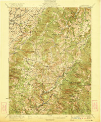
1922 Map of Donegal
USGS Topo · Published 1922About this map
Indian Creek carves a deep path through the southern portion of this region, where the Pennsylvania RR and small settlements like Indian Head and Melcroft followed the water. Further north, the landscape is dotted with early 20th-century industry and community anchors, from the Mansville Keffer P.O. to local processing sites like Hoods Mill and Rowers Mill. The map reveals a dense network of one-room schoolhouses, including the uniquely named Snowball School and Puckety School, which served the rural families of Donegal and Mount Pleasant townships.
Find a feature on this map
116 named features on this map. Tap any name to fly to it.
Don’t see what you’re looking for? This feature index may not catch every label — zoom into the map to look around manually.
Map Details
Editions of this 1922 Donegal Map
2 editions found

Other maps of this area

1900 · Uniontown
USGS Topo · 1:62,500

1900 · Latrobe
USGS Topo · 1:62,500

1902 · Latrobe
USGS Topo · 1:62,500

1902 · Connellsville
USGS Topo · 1:62,500

1903 · Latrobe
USGS Topo · 1:62,500

1904 · Greensburg
USGS Topo · 1:62,500

1906 · Greensburg
USGS Topo · 1:62,500

1913 · Somerset
USGS Topo · 1:62,500

1915 · Somerset
USGS Topo · 1:62,500

1920 · New Florence
USGS Topo · 1:62,500