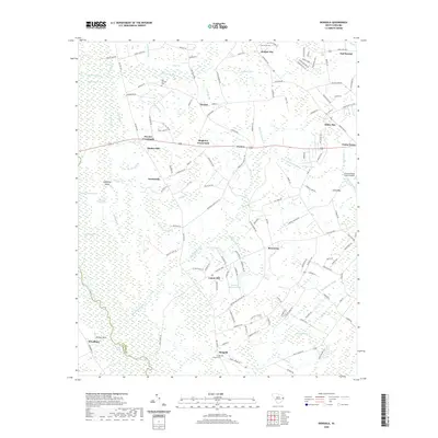
2020 Map of Dongola
USGS Topo · Published 2020About this map
Little Pee Dee River and the expansive Hunting Swamp dominate this part of Horry County, where the landscape is defined by its intricate network of blackwater creeks and bays. The settlement of Dongola sits near the Pauley Swamp Cem, while the crossroads communities of Singleton Crossroads and Pee Dee Crossroads mark the intersections of the local road system. The terrain is a complex mosaic of water and land, featuring Sandy Island Lake and the larger Juniper Bay to the north. These features are characteristic of the Carolina Bays region, where elliptical depressions and wetland basins create a unique ecological and topographical pattern. For genealogists and local historians, the map preserves the locations of family-associated sites like Martins Fishing Pond and Mack James Pond, alongside evidence of historical transit such as Old Railroad Rd.
Find a feature on this map
147 named features on this map. Tap any name to fly to it.
Don’t see what you’re looking for? This feature index may not catch every label — zoom into the map to look around manually.
Map Details
Editions of this 2020 Dongola Map
This is the sole edition of this map. No revisions or reprints were ever made.
Other maps of this area

1943 · Yauhannah
USGS Topo · 1:24,000

1943 · Bucksville
USGS Topo · 1:24,000

1943 · Dongola
USGS Topo · 1:24,000

1943 · Adrian
USGS Topo · 1:24,000

1943 · Horry
USGS Topo · 1:24,000

1943 · Conway
USGS Topo · 1:24,000

1943 · Outland
USGS Topo · 1:24,000

1944 · Outland
USGS Topo · 1:31,680

1944 · Adrian
USGS Topo · 1:31,680

1946 · Johnsonville
USGS Topo · 1:62,500