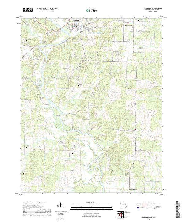
2021 Map of Doniphan South
USGS Topo · Published 2021About this map
The Current River carves a winding path through this portion of Ripley County, serving as the primary geographic focal point for the surrounding settlements. In the northern reaches, Doniphan serves as a hub of local activity, centered around the Ripley County Courthouse. The landscape is defined by its drainages and family-named hollows, including Turkeypen Hollow and Pine Hill Hollow, which feed into the river system. Downstream, the river navigates around Big Island before reaching the southern communities of Pratt and Current View. The area is notably dense with small family and community burial grounds, such as Amity Cem, Towles Cem, and Sanky Hall Cem, which offer significant value for genealogical research. Large distinctive features like Gartman Rock and the Davis Cutoff further characterize the river's influence on the local terrain and historical land use patterns.
Find a feature on this map
101 named features on this map. Tap any name to fly to it.
Don’t see what you’re looking for? This feature index may not catch every label — zoom into the map to look around manually.
Map Details
Editions of this 2021 Doniphan South Map
This is the sole edition of this map. No revisions or reprints were ever made.
Other maps of this area

1935 · Acorn
USGS Topo · 1:62,500

1935 · Knobel
USGS Topo · 1:62,500

1935 · Reyno
USGS Topo · 1:62,500

1939 · Doniphan
USGS Topo · 1:62,500

1940 · Naylor
USGS Topo · 1:62,500

1941 · Knobel
USGS Topo · 1:62,500

1944 · Naylor
USGS Topo · 1:62,500

1945 · Doniphan
USGS Topo · 1:62,500

1957 · Poplar Bluff
USGS Topo · 1:250,000

1959 · Poplar Bluff
USGS Topo · 1:250,000