
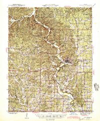
1945 Map of Doniphan
USGS Topo · Published 1945About this map
The Current River defines the landscape of southern Ripley County, winding through a network of riverside camps and eddies including Pigs Ankle, Hargus Eddy, and Bay Mill Eddy. This 1945 survey documents the area's transition into a regional recreational and transit hub, anchored by the county seat at Doniphan where the Missouri Pacific railroad terminates. The river is lined with social landmarks like the Dudleys Club and Skipper Johnson Club, alongside seasonal retreats like Loreys Cabins.
Find a feature on this map
114 named features on this map. Tap any name to fly to it.
Don’t see what you’re looking for? This feature index may not catch every label — zoom into the map to look around manually.
Map Details
Editions of this 1945 Doniphan Map
2 editions found
Other maps of this area

1934 · Williamsville
USGS Topo · 1:48,000

1935 · Acorn
USGS Topo · 1:62,500

1935 · Knobel
USGS Topo · 1:62,500

1935 · Reyno
USGS Topo · 1:62,500

1939 · Doniphan
USGS Topo · 1:62,500

1940 · Williamsville
USGS Topo · 1:62,500

1940 · Naylor
USGS Topo · 1:62,500

1941 · Gatewood
USGS Topo · 1:62,500

1941 · Knobel
USGS Topo · 1:62,500

1944 · Naylor
USGS Topo · 1:62,500