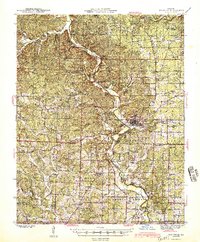
1945 Map of Doniphan
USGS Topo · Published 1945About this map
The Current River winds prominently through this part of Ripley County, serving as the central geographic feature of the region in the mid-1940s. The county seat of Doniphan acts as a hub for the surrounding landscape, which is densely populated with small rural institutions. This survey documents an extensive network of school districts, including Pleasant Grove Sch, Mill Creek Sch, and Rosson Sch, illustrating the dispersed nature of education before district consolidation. Along the river, localized landmarks such as Bluff Cottage, Hargus Eddy, and Skipper Johnson Cave denote a landscape deeply utilized for recreation and river-based activity. Near the southern border with Arkansas, the settlement of Current View and the town of Poynor provide a window into the community structure of the Ozark foothills during this era, while family-named sites like Shirley Cem and Mizell Cem offer significant data for genealogical research.
Find a feature on this map
98 named features on this map. Tap any name to fly to it.
Don’t see what you’re looking for? This feature index may not catch every label — zoom into the map to look around manually.
Map Details
Editions of this 1945 Doniphan Map
2 editions found

Other maps of this area

1934 · Williamsville
USGS Topo · 1:48,000

1935 · Acorn
USGS Topo · 1:62,500

1935 · Knobel
USGS Topo · 1:62,500

1935 · Reyno
USGS Topo · 1:62,500

1939 · Doniphan
USGS Topo · 1:62,500

1940 · Williamsville
USGS Topo · 1:62,500

1940 · Naylor
USGS Topo · 1:62,500

1941 · Gatewood
USGS Topo · 1:62,500

1941 · Knobel
USGS Topo · 1:62,500

1944 · Naylor
USGS Topo · 1:62,500