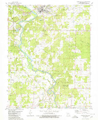
1980 Map of Doniphan South
USGS Topo · Published 1980About this map
The Current River defines the landscape of this southern Missouri region, winding past Big Island as it flows toward the Arkansas border. In 1980, the town of Doniphan serves as the primary hub at the northern edge, with smaller communities like Current View and Pratt scattered south toward the state line. The terrain is deeply carved by drainage systems including McKinney Creek, Logan Creek, and Hurricane Creek, which flow through heavily timbered areas and the southern reaches of the Fourche Creek State Forest.
Find a feature on this map
44 named features on this map. Tap any name to fly to it.
Don’t see what you’re looking for? This feature index may not catch every label — zoom into the map to look around manually.
Map Details
Editions of this 1980 Doniphan South Map
This is the sole edition of this map. No revisions or reprints were ever made.
Other maps of this area

1935 · Acorn
USGS Topo · 1:62,500

1935 · Knobel
USGS Topo · 1:62,500

1935 · Reyno
USGS Topo · 1:62,500

1939 · Doniphan
USGS Topo · 1:62,500

1940 · Naylor
USGS Topo · 1:62,500

1941 · Knobel
USGS Topo · 1:62,500

1944 · Naylor
USGS Topo · 1:62,500

1945 · Doniphan
USGS Topo · 1:62,500

1957 · Poplar Bluff
USGS Topo · 1:250,000

1959 · Poplar Bluff
USGS Topo · 1:250,000