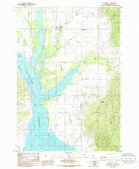
1985 Map of Donnelly
USGS Topo · Published 1986About this map
Donnelly and the adjacent settlement of Roseberry occupy the heart of Long Valley in this mid-1980s survey. The landscape is defined by the extensive waters of the Cascade Reservoir, which dominates the western half of the map and includes underwater contours based on earlier 1930s investigations. This era shows the community supporting both local agriculture and recreation, evidenced by a Trailer Park and Campground near the shoreline.
Find a feature on this map
27 named features on this map. Tap any name to fly to it.
Don’t see what you’re looking for? This feature index may not catch every label — zoom into the map to look around manually.
Map Details
Editions of this 1985 Donnelly Map
This is the sole edition of this map. No revisions or reprints were ever made.
Other maps of this area

1911 · Meadows
USGS Topo · 1:125,000

1954 · Gold Fork
USGS Topo · 1:62,500

1954 · Cascade
USGS Topo · 1:62,500

1955 · Baker
USGS Topo · 1:250,000

1957 · Challis
USGS Topo · 1:250,000

1959 · Baker
USGS Topo · 1:250,000

1960 · Challis
USGS Topo · 1:250,000

1963 · Challis
USGS Topo · 1:250,000
1973 · No Business Mtn
USGS Topo · 1:24,000
1973 · Paddy Flat
USGS Topo · 1:24,000