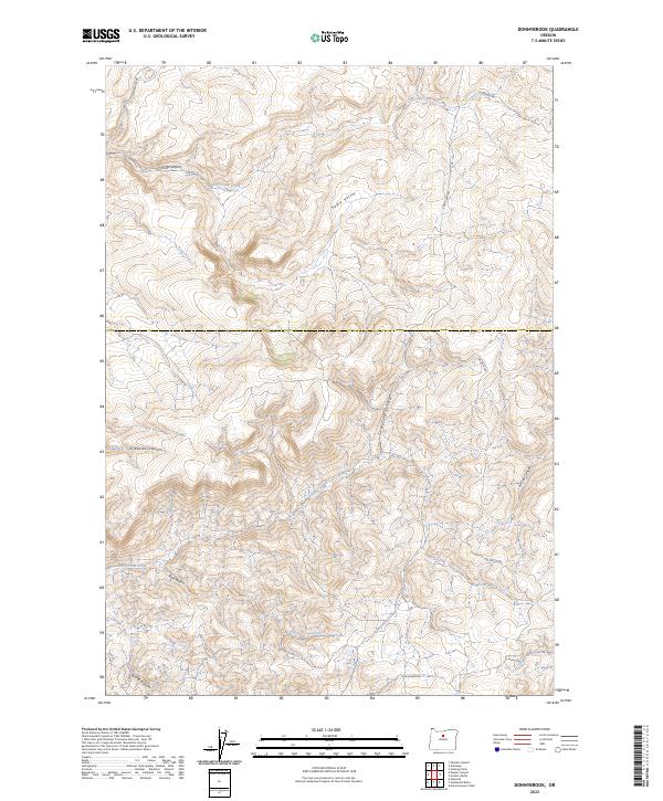
2023 Map of Donnybrook
USGS Topo · Published 2023About this map
Eagle Valley and the high desert terrain of north-central Oregon define this region within Jefferson County. The landscape is a complex of deep drainages and ridges, including Kirkbride Canyon and the winding course of King Canyon. Water remains a central geographic element in this arid environment, represented by Cold Camp Creek in the north and Little Trout Creek in the south. The road network reflects the area's grazing and ranching heritage, with routes like Muddy Rd and Tub Springs Rd following natural contours between canyons. This 2023 survey by the U.S. Geological Survey provides high-resolution data on the intricate topography of Post Hollow and Trail Hollow, showing the modern land management boundaries of T8S R17E and T9S R17E as they intersect this rugged landscape.
Find a feature on this map
18 named features on this map. Tap any name to fly to it.
Don’t see what you’re looking for? This feature index may not catch every label — zoom into the map to look around manually.
Map Details
Editions of this 2023 Donnybrook Map
This is the sole edition of this map. No revisions or reprints were ever made.
Other maps of this area

1955 · Bend
USGS Topo · 1:250,000

1957 · Bend
USGS Topo · 1:250,000

1958 · Bend
USGS Topo · 1:250,000

1966 · Antelope
USGS Topo · 1:62,500

1966 · Willowdale
USGS Topo · 1:62,500

1968 · Horse Heaven Creek
USGS Topo · 1:24,000

1968 · Axehandle Butte
USGS Topo · 1:24,000

1968 · Ashwood
USGS Topo · 1:24,000

1981 · Stephenson Mountain
USGS Topo · 1:100,000
1987 · Donnybrook
USGS Topo · 1:24,000