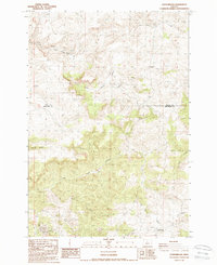
1987 Map of Donnybrook
USGS Topo · Published 1988About this map
Donnybrook and the surrounding high desert of the Oregon interior are captured in this mid-1980s survey. The landscape is defined by its drainage systems, notably Eagle Creek Valley and Little Trout Creek, which carve through the plateau. A small settlement at Post serves as a primary marker of human habitation in this isolated stretch where the boundary of Wasco and Jefferson counties meets. The map provides a detailed view of the terrain before later 20th-century shifts, showing a region where life was dictated by the availability of water and the rugged topography of central Oregon.
Find a feature on this map
4 named features on this map. Tap any name to fly to it.
Don’t see what you’re looking for? This feature index may not catch every label — zoom into the map to look around manually.
Map Details
Editions of this 1987 Donnybrook Map
This is the sole edition of this map. No revisions or reprints were ever made.
Other maps of this area

1955 · Bend
USGS Topo · 1:250,000

1957 · Bend
USGS Topo · 1:250,000

1958 · Bend
USGS Topo · 1:250,000

1966 · Antelope
USGS Topo · 1:62,500

1966 · Willowdale
USGS Topo · 1:62,500

1968 · Horse Heaven Creek
USGS Topo · 1:24,000

1968 · Axehandle Butte
USGS Topo · 1:24,000

1968 · Ashwood
USGS Topo · 1:24,000

1981 · Stephenson Mountain
USGS Topo · 1:100,000
1987 · Degner Canyon
USGS Topo · 1:24,000