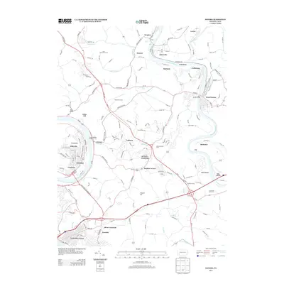
2013 Map of Donora
USGS Topo · Published 2013About this map
The Monongahela River and Youghiogheny River define the industrial and residential geography of this western Pennsylvania region. The city of Donora occupies a prominent bend in the Monongahela, connected to Webster by the Donora Webster Bridge. Further east, the Youghiogheny facilitates the growth of towns like Sutersville, West Newton, and Smithdale. The area between these river valleys is a transition of ridge lines and hollows, featuring Sheppler Hill and Becketts Run. Long-standing agricultural and community landmarks like the Rostraver Grange sit alongside modern developments such as the Rostraver Airport. This 2013 survey illustrates how transportation networks, including the Donora Webster Bridge and numerous local routes like Rostraver Rd, continue to bind these riverfront settlements together while preserving historic place names like Reduction and Collinsburg.
Find a feature on this map
148 named features on this map. Tap any name to fly to it.
Don’t see what you’re looking for? This feature index may not catch every label — zoom into the map to look around manually.
Map Details
Editions of this 2013 Donora Map
This is the sole edition of this map. No revisions or reprints were ever made.
Other maps of this area

1902 · Brownsville
USGS Topo · 1:62,500

1902 · Connellsville
USGS Topo · 1:62,500

1904 · Mc Keesport
USGS Topo · 1:62,500

1904 · Greensburg
USGS Topo · 1:62,500

1906 · Brownsville
USGS Topo · 1:62,500

1906 · Greensburg
USGS Topo · 1:62,500

1907 · Pittsburg
USGS Topo · 1:62,500

1931 · Brownsville
USGS Topo · 1:62,500

1931 · Connellsville
USGS Topo · 1:62,500

1933 · Brownsville
USGS Topo · 1:62,500