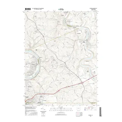
2016 Map of Donora
USGS Topo · Published 2016About this map
The Youghiogheny River and Monongahela River dominate this industrial landscape of southwestern Pennsylvania, carving through a region defined by steep valleys and closely packed settlements. Major population centers like Monessen and Donora sit along the western riverbanks, while West Newton and Sutersville anchor the Youghiogheny to the east. The map reveals the intricate transportation network necessary for this river-valley economy, showing the Donora-Webster Bridge and the rail lines of Norfolk Southern and CSX Transportation that trace the water level.
Find a feature on this map
235 named features on this map. Tap any name to fly to it.
Don’t see what you’re looking for? This feature index may not catch every label — zoom into the map to look around manually.
Map Details
Editions of this 2016 Donora Map
This is the sole edition of this map. No revisions or reprints were ever made.
Other maps of this area

1902 · Brownsville
USGS Topo · 1:62,500

1902 · Connellsville
USGS Topo · 1:62,500

1904 · Mc Keesport
USGS Topo · 1:62,500

1904 · Greensburg
USGS Topo · 1:62,500

1906 · Brownsville
USGS Topo · 1:62,500

1906 · Greensburg
USGS Topo · 1:62,500

1907 · Pittsburg
USGS Topo · 1:62,500

1931 · Brownsville
USGS Topo · 1:62,500

1931 · Connellsville
USGS Topo · 1:62,500

1933 · Brownsville
USGS Topo · 1:62,500