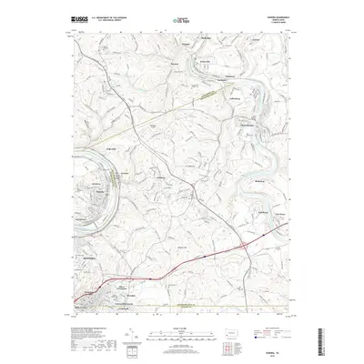
2019 Map of Donora
USGS Topo · Published 2019About this map
The Monongahela River and Youghiogheny River carve deep valleys through this industrial heartland, where the city of Monessen and the borough of Donora anchor a landscape defined by steel-town heritage and river commerce. This 2019 survey traces the intricate rail networks of the Norfolk Southern Railway and Wheeling & Lake Erie Railway as they follow the water's edge, connecting established riverfront settlements like Sutersville, West Newton, and Webster.
Find a feature on this map
246 named features on this map. Tap any name to fly to it.
Don’t see what you’re looking for? This feature index may not catch every label — zoom into the map to look around manually.
Map Details
Editions of this 2019 Donora Map
This is the sole edition of this map. No revisions or reprints were ever made.
Other maps of this area

1902 · Brownsville
USGS Topo · 1:62,500

1902 · Connellsville
USGS Topo · 1:62,500

1904 · Mc Keesport
USGS Topo · 1:62,500

1904 · Greensburg
USGS Topo · 1:62,500

1906 · Brownsville
USGS Topo · 1:62,500

1906 · Greensburg
USGS Topo · 1:62,500

1907 · Pittsburg
USGS Topo · 1:62,500

1931 · Brownsville
USGS Topo · 1:62,500

1931 · Connellsville
USGS Topo · 1:62,500

1933 · Brownsville
USGS Topo · 1:62,500