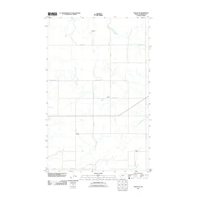
2011 Map of Dooley SE
USGS Topo · Published 2011About this map
Trinity Cemetery and Bethany Cemetery stand as quiet landmarks within this rural section of Sheridan County, where the landscape is defined by the ephemeral drainage patterns of the northern plains. The map reveals a grid of section-line roads, including S Comertown Rd and Dutch Valley Rd, providing access to isolated ranching and agricultural tracts. Water management is a central feature of life in this arid region, as seen by the presence of small impoundments such as Soderquist Dam and Thomas Dam. These structures sit along the seasonal flows of Antelope Creek and its tributaries like Marron Crk, illustrating the infrastructure required to sustain local land use. This survey captures a moment in the early 21st century when the traditional road network, featuring names like Lone Star and Soderquist Rd, continued to anchor the community's geographical identity.
Find a feature on this map
16 named features on this map. Tap any name to fly to it.
Don’t see what you’re looking for? This feature index may not catch every label — zoom into the map to look around manually.
Map Details
Editions of this 2011 Dooley SE Map
This is the sole edition of this map. No revisions or reprints were ever made.
Other maps of this area

1948 · Antelope
USGS Topo · 1:24,000

1949 · Antelope
USGS Topo · 1:24,000

1954 · Wolf Point
USGS Topo · 1:250,000

1958 · Wolf Point
USGS Topo · 1:250,000

1983 · Dooley
USGS Topo · 1:24,000

1983 · Tadpole Lake
USGS Topo · 1:24,000

1983 · Dooley SW
USGS Topo · 1:24,000

1983 · Dooley SE
USGS Topo · 1:24,000

1983 · Lone Tree Lake
USGS Topo · 1:24,000
1983 · Coalridge
USGS Topo · 1:24,000