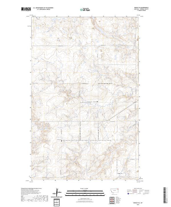
2024 Map of Dooley SE
USGS Topo · Published 2024About this map
Antelope Creek and its southern fork wind through this Sheridan County landscape, shaping a terrain defined by drainage patterns and rural access roads. The placement of Trinity Cem and Bethany Cem near the intersection of local routes like Dutch Valley Rd and Ator Creek Rd points to the area's long-standing community centers in this northern Montana prairie. These cemeteries serve as vital anchors for genealogical research, marking the location of early homestead-era settlements and family plots that predated more modern infrastructure. A network of section-line roads, including Soderquist Rd and Comertown Rd, illustrates the persistent grid system of the Public Land Survey System that continues to organize the agricultural life of the region today.
Find a feature on this map
19 named features on this map. Tap any name to fly to it.
Don’t see what you’re looking for? This feature index may not catch every label — zoom into the map to look around manually.
Map Details
Editions of this 2024 Dooley SE Map
This is the sole edition of this map. No revisions or reprints were ever made.
Other maps of this area

1948 · Antelope
USGS Topo · 1:24,000

1949 · Antelope
USGS Topo · 1:24,000

1954 · Wolf Point
USGS Topo · 1:250,000

1958 · Wolf Point
USGS Topo · 1:250,000

1983 · Dooley
USGS Topo · 1:24,000

1983 · Tadpole Lake
USGS Topo · 1:24,000

1983 · Dooley SW
USGS Topo · 1:24,000

1983 · Dooley SE
USGS Topo · 1:24,000

1983 · Lone Tree Lake
USGS Topo · 1:24,000
1983 · Coalridge
USGS Topo · 1:24,000