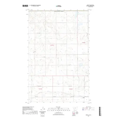
2020 Map of Dooley
USGS Topo · Published 2020About this map
Dooley sits in the southeastern corner of this Sheridan County landscape, where the northern high plains of Montana meet the international border with Canada. The area is defined by a sparse network of section-line roads and named routes that cross the prairie, including the evocative Outlaw Coulee Rd and the Raymond Dooley Rd. This rural environment supports isolated landmarks essential for local history and genealogy, such as the Wankel Cem located in the western portion of the township. The drainage and topography are subtle, with Spring Creek Rd and Box Elder Rd following the low-lying contours of the land. A complex of small water bodies and seasonal wetlands dot the terrain, particularly near Salt Lake Rd, illustrating the natural hydrology of this borderland region.
Find a feature on this map
15 named features on this map. Tap any name to fly to it.
Don’t see what you’re looking for? This feature index may not catch every label — zoom into the map to look around manually.
Map Details
Editions of this 2020 Dooley Map
This is the sole edition of this map. No revisions or reprints were ever made.
Other maps of this area

1954 · Wolf Point
USGS Topo · 1:250,000

1958 · Wolf Point
USGS Topo · 1:250,000

1983 · Dooley
USGS Topo · 1:24,000

1983 · Dooley SW
USGS Topo · 1:24,000

1983 · Dooley SE
USGS Topo · 1:24,000

1983 · Park Lake
USGS Topo · 1:24,000

1983 · Plentywood
USGS Topo · 1:24,000

1983 · Raymond
USGS Topo · 1:24,000
2011 · Dooley
USGS Topo · 1:24,000
2011 · Dooley SW
USGS Topo · 1:24,000