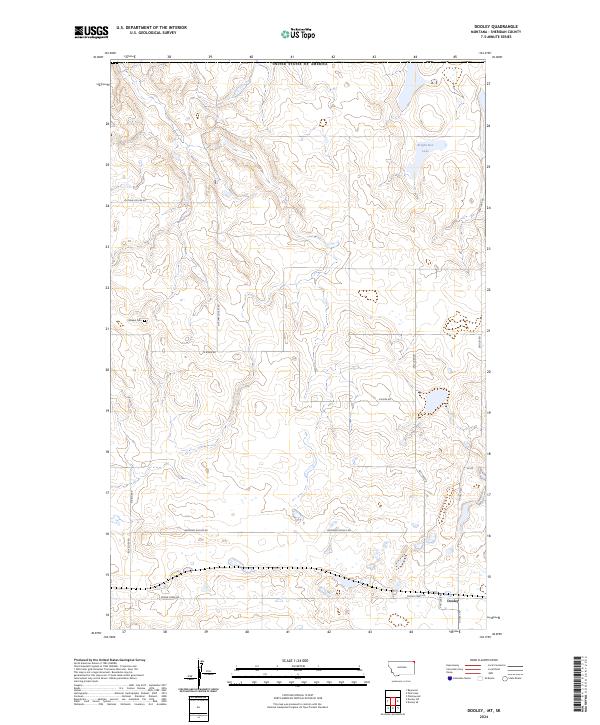
2024 Map of Dooley
USGS Topo · Published 2024About this map
Dooley sits at the intersection of a vast prairie road network in Sheridan County, near the northern border of the United States of America. This landscape is defined by the high plains topography typical of the Montana-Saskatchewan borderlands, where seasonal drainages and small basins dictate the movement of travelers. The naming of Outlaw Coulee Rd suggests a rugged history of the local terrain, while the solitary Wankel Cem serves as a significant genealogical marker for the descendants of early homesteading families in this corner of the state.
Find a feature on this map
17 named features on this map. Tap any name to fly to it.
Don’t see what you’re looking for? This feature index may not catch every label — zoom into the map to look around manually.
Map Details
Editions of this 2024 Dooley Map
This is the sole edition of this map. No revisions or reprints were ever made.
Other maps of this area

1954 · Wolf Point
USGS Topo · 1:250,000

1958 · Wolf Point
USGS Topo · 1:250,000

1983 · Dooley
USGS Topo · 1:24,000

1983 · Dooley SW
USGS Topo · 1:24,000

1983 · Dooley SE
USGS Topo · 1:24,000

1983 · Park Lake
USGS Topo · 1:24,000

1983 · Plentywood
USGS Topo · 1:24,000

1983 · Raymond
USGS Topo · 1:24,000
2011 · Dooley
USGS Topo · 1:24,000
2011 · Dooley SW
USGS Topo · 1:24,000