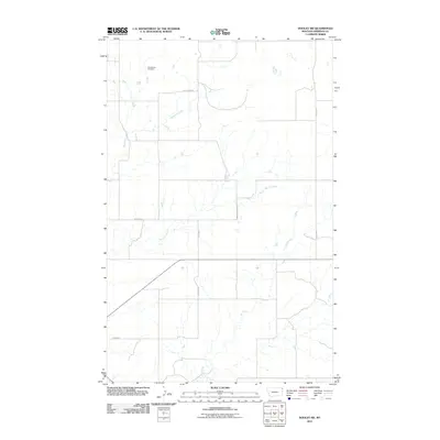
2011 Map of Dooley SW
USGS Topo · Published 2011About this map
Christensen Cemetery sits at the head of a drainage system in this corner of Sheridan County, where the high plains landscape is defined by the ephemeral winding of Boxelder Creek and Marron Creek. In the early twenty-first century, this area remains a grid of section-line roads and rural corridors such as Fourmile Rd and Dooley Rd. The land's character is shaped by a series of small, unnamed potholes and seasonal water bodies typical of the glaciated plains, with Ator Creek draining the southeastern portion of the quadrangle. Aside from the cemetery, which provides a genealogical anchor for the community, the map highlights the sparse infrastructure of the region, including the curiously named La Migra road in the southwest corner near the county’s expansive ranchlands.
Find a feature on this map
11 named features on this map. Tap any name to fly to it.
Don’t see what you’re looking for? This feature index may not catch every label — zoom into the map to look around manually.
Map Details
Editions of this 2011 Dooley SW Map
This is the sole edition of this map. No revisions or reprints were ever made.
Other maps of this area

1948 · Antelope
USGS Topo · 1:24,000

1949 · Antelope
USGS Topo · 1:24,000

1950 · Shippe Canyon
USGS Topo · 1:24,000

1954 · Wolf Point
USGS Topo · 1:250,000

1958 · Wolf Point
USGS Topo · 1:250,000

1983 · Dooley
USGS Topo · 1:24,000

1983 · Dooley SW
USGS Topo · 1:24,000

1983 · Dooley SE
USGS Topo · 1:24,000

1983 · Park Lake
USGS Topo · 1:24,000

1983 · Plentywood
USGS Topo · 1:24,000