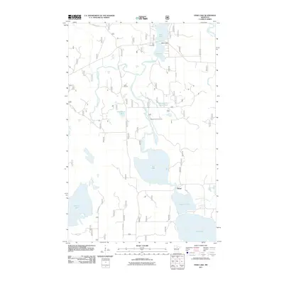
2011 Map of Dora Lake
USGS Topo · Published 2011About this map
Dora Lake and the Bowstring River drainage define this section of the northern Minnesota landscape. This 2011 survey illustrates a region where water and forest management are central to the geography, anchored by the settlement of Dora Lake and the former logging or agricultural outpost of Oslund. The Bowstring River winds through the center of the sheet, feeding into Shogrean Dam Impoundment and Rice Lake, reflecting a complex hydrological network that also includes the Popple River and Big Fork River. Local history is preserved at the Popple Cemetery, while recreational access points like the Dora Lake Picnic Area and Shogrean Dam Picnic Area indicate the modern land use of these timberlands. The presence of Schoolhouse Lake suggests the locations of earlier rural communities that once supported families along what are now forest roads and county routes like Co Rd 128.
Find a feature on this map
27 named features on this map. Tap any name to fly to it.
Don’t see what you’re looking for? This feature index may not catch every label — zoom into the map to look around manually.
Map Details
Editions of this 2011 Dora Lake Map
This is the sole edition of this map. No revisions or reprints were ever made.
Other maps of this area

1918 · Zora
USGS Topo · 1:62,500

1919 · Zora
USGS Topo · 1:62,500

1919 · Gemmell
USGS Topo · 1:62,500

1919 · Max
USGS Topo · 1:62,500

1954 · Bemidji
USGS Topo · 1:250,000

1954 · Hibbing
USGS Topo · 1:250,000

1957 · Bemidji
USGS Topo · 1:250,000

1957 · Hibbing
USGS Topo · 1:250,000

1958 · Bemidji
USGS Topo · 1:250,000

1958 · Hibbing
USGS Topo · 1:250,000