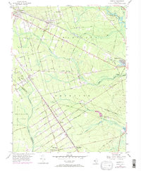
1956 Map of Dorothy
USGS Topo · Published 1973About this map
The Pennsylvania-Reading Seashore Lines cuts a diagonal path through this South Jersey landscape, connecting a string of small settlements established in the pine forests and sandy soils. The village of Dorothy serves as a central hub, while other distinct communities like Mizpah, Richland, and Milmay punctuate the rail corridor. The map reveals the civic fabric of the era through sites like St Johns Ch, School No 5, and the Estell Manor Sch.
Find a feature on this map
37 named features on this map. Tap any name to fly to it.
Don’t see what you’re looking for? This feature index may not catch every label — zoom into the map to look around manually.
Map Details
Editions of this 1956 Dorothy Map
4 editions found
Other maps of this area

1890 · Great Egg Harbor
USGS Topo · 1:62,500

1890 · Hammonton
USGS Topo · 1:62,500

1890 · Tuckahoe
USGS Topo · 1:62,500

1890 · Mullica
USGS Topo · 1:62,500

1893 · Great Egg Harbor
USGS Topo · 1:62,500

1893 · Tuckahoe
USGS Topo · 1:62,500

1894 · Hammonton
USGS Topo · 1:62,500

1894 · Mullica
USGS Topo · 1:62,500

1898 · Mullica
USGS Topo · 1:62,500

1898 · Hammonton
USGS Topo · 1:62,500
Featured Places
- Hamilton Township, NJ
- Maurice River Township, NJ
- Buena Vista Township, NJ
- Weymouth Township, NJ
- Estell Manor, NJ