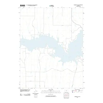
2010 Map of Dorrance NE
USGS Topo · Published 2010About this map
Wilson Lake dominates this Russell County landscape, where the waters of the Saline River are impounded within the Central Plains. This 2010 survey illustrates the complex shoreline and surrounding infrastructure during the early 21st century, revealing a network of rural roads that serve the reservoir area. The convergence of Hell Creek from the east and the primary river channel creates a distinctive topography of inlets and peninsulas. Significant thoroughfares like Dorrance-Lucas Rd and 204th Blvd provide access across the southern reaches, while Dam Rd skirts the northern edge of the impoundment. The map reflects a landscape defined by water management and recreational geography, with named routes like Balta Rd and 200th Rd tracing the section lines of the surrounding prairie.
Find a feature on this map
16 named features on this map. Tap any name to fly to it.
Don’t see what you’re looking for? This feature index may not catch every label — zoom into the map to look around manually.
Map Details
Editions of this 2010 Dorrance NE Map
This is the sole edition of this map. No revisions or reprints were ever made.
Other maps of this area

1894 · Ellsworth
USGS Topo · 1:125,000

1894 · Beloit
USGS Topo · 1:125,000

1896 · Osborne
USGS Topo · 1:125,000

1896 · Russell
USGS Topo · 1:125,000

1955 · Great Bend
USGS Topo · 1:250,000

1955 · Beloit
USGS Topo · 1:250,000

1956 · Wilson
USGS Topo · 1:24,000

1956 · Dorrance
USGS Topo · 1:24,000

1956 · Dorrance SW
USGS Topo · 1:24,000

1957 · Great Bend
USGS Topo · 1:250,000