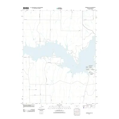
2012 Map of Dorrance NE
USGS Topo · Published 2012About this map
Wilson Lake dominates this central Kansas landscape, its branching shorelines creating a complex geography of inlets and peninsulas north of Dorrance. The eastern reaches of the lake are home to several developed recreation areas within Wilson State Park, including the Wilson State Park Hell Creek Boat Ramp and a series of themed sites like the Wilson State Park Side Oats Campground and Wilson State Park Little Bluestem Campground. A grid of rural sections surrounds the water, defined by roads like Dorrance Lucas Rd and Reservoir Rd that provide access to the lake's northern and southern banks. The map illustrates the 2012 infrastructure of the region, from the Dam Rd crossing to the localized paths of Balta Rd and Balta Ln, reflecting the intersection of local agriculture and regional water management.
Find a feature on this map
25 named features on this map. Tap any name to fly to it.
Don’t see what you’re looking for? This feature index may not catch every label — zoom into the map to look around manually.
Map Details
Editions of this 2012 Dorrance NE Map
This is the sole edition of this map. No revisions or reprints were ever made.
Other maps of this area

1894 · Ellsworth
USGS Topo · 1:125,000

1894 · Beloit
USGS Topo · 1:125,000

1896 · Osborne
USGS Topo · 1:125,000

1896 · Russell
USGS Topo · 1:125,000

1955 · Great Bend
USGS Topo · 1:250,000

1955 · Beloit
USGS Topo · 1:250,000

1956 · Wilson
USGS Topo · 1:24,000

1956 · Dorrance
USGS Topo · 1:24,000

1956 · Dorrance SW
USGS Topo · 1:24,000

1957 · Great Bend
USGS Topo · 1:250,000