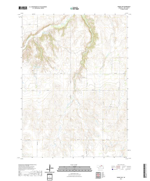
2021 Map of Dorsey NW
USGS Topo · Published 2021About this map
Redbird Cr and its tributaries carve a network of drainages through this portion of Holt County, defining a rural landscape dominated by water management and section-line roads. The hydrology is marked by the presence of Witt Reservoir Number 1 in the north and Becker Reservoir Number 2 further south, illustrating the importance of water storage in this agricultural region. The map reveals a high density of named watercourses, including Louse Cr with its East and West branches, alongside Sand Cr and Red Otter Cr. This 2021 survey illustrates how the township and range system has dictated the local geography, with roads like 888th Rd Co Rd and Oil Co Rd following precise cardinal directions across the varying elevations of the Nebraska plains.
Find a feature on this map
30 named features on this map. Tap any name to fly to it.
Don’t see what you’re looking for? This feature index may not catch every label — zoom into the map to look around manually.
Map Details
Editions of this 2021 Dorsey NW Map
This is the sole edition of this map. No revisions or reprints were ever made.
Other maps of this area

1950 · Dorsey NW
USGS Topo · 1:24,000

1950 · Lynch
USGS Topo · 1:24,000

1950 · Monowi
USGS Topo · 1:24,000

1951 · Bristow
USGS Topo · 1:24,000

1952 · Monowi
USGS Topo · 1:24,000

1952 · Dorsey
USGS Topo · 1:24,000

1954 · Dorsey SW
USGS Topo · 1:24,000

1954 · Meek NE
USGS Topo · 1:24,000

1954 · Opportunity
USGS Topo · 1:24,000

1954 · Star
USGS Topo · 1:24,000