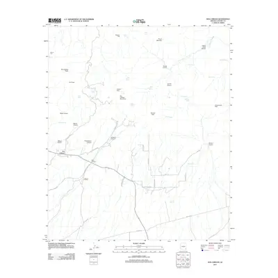
2011 Map of Dos Cabezas
USGS Topo · Published 2011About this map
The Dos Cabezas settlement sits at the heart of this landscape, flanked by the high elevations of the Dos Cabezas Mountains and the distinct Dos Cabezas Peaks. The area’s rugged character is defined by numerous drainage systems such as Mascot Canyon, Philadelphia Canyon, and the deep Happy Camp Canyon to the northeast. Transportation and ranching history are visible through a network of local routes like S Butterfield Rd, S Hurtado Ranch Rd, and the S Mascot Mine Rd, leading toward sites like Mineral Park. Water security in this arid terrain is marked by a high density of named springs, including White Rock Spring, Casa Piedra Spring, and Mexican Spring. The map reveals a transition from these mountain drainages down to the flatter lands around Rancho Sacatal, providing a record of rural Cochise County land use and geography.
Find a feature on this map
51 named features on this map. Tap any name to fly to it.
Don’t see what you’re looking for? This feature index may not catch every label — zoom into the map to look around manually.
Map Details
Editions of this 2011 Dos Cabezas Map
This is the sole edition of this map. No revisions or reprints were ever made.
Other maps of this area

1917 · San Simon
USGS Topo · 1:125,000

1922 · Willcox
USGS Topo · 1:125,000

1926 · Cochise Head
USGS Topo · 1:62,500

1928 · Bowie
USGS Topo · 1:62,500

1943 · Dos Cabezas
USGS Topo · 1:62,500

1944 · Fisher Hills
USGS Topo · 1:62,500

1949 · Bowie
USGS Topo · 1:62,500

1950 · Bowie
USGS Topo · 1:62,500

1950 · Cochise Head
USGS Topo · 1:62,500

1954 · Silver City
USGS Topo · 1:250,000