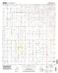
1996 Map of Dos Cabezas SW
USGS Topo · Published 2002About this map
Scattered infrastructure for ranching and water management defines this 1996 landscape in southeastern Arizona. The terrain is marked by a network of numerous Well sites and a prominent Draw that cuts across the northeastern section, indicating the area's reliance on groundwater and seasonal drainage. Large-scale utility development is evident through the presence of a significant Pipeline and multiple Pipelines traversing the northern townships.
Find a feature on this map
11 named features on this map. Tap any name to fly to it.
Don’t see what you’re looking for? This feature index may not catch every label — zoom into the map to look around manually.
Map Details
Editions of this 1996 Dos Cabezas SW Map
This is the sole edition of this map. No revisions or reprints were ever made.
Other maps of this area

1916 · Pearce
USGS Topo · 1:125,000

1922 · Willcox
USGS Topo · 1:125,000

1926 · Light
USGS Topo · 1:62,500

1926 · Courtland
USGS Topo · 1:62,500

1943 · Dos Cabezas
USGS Topo · 1:62,500

1943 · Cochise
USGS Topo · 1:62,500

1954 · Silver City
USGS Topo · 1:250,000

1955 · Douglas
USGS Topo · 1:250,000

1957 · Dos Cabezas
USGS Topo · 1:62,500

1958 · Silver City
USGS Topo · 1:250,000