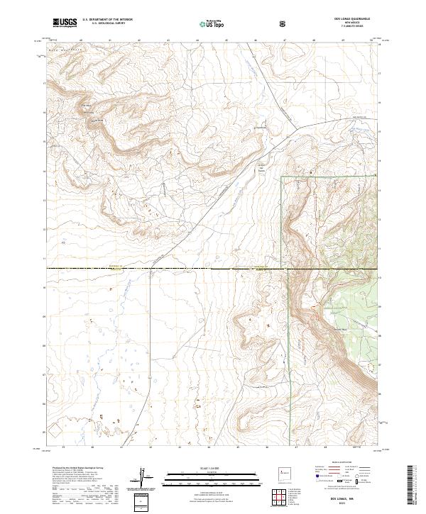
2023 Map of Dos Lomas
USGS Topo · Published 2023About this map
Dos Lomas and El Puertecito anchor this survey of the New Mexico landscape, situated where the high desert meets the structured boundaries of the Cibola National Forest. The map documents a complex drainage system defined by San Mateo Creek and Arroyo del Puerto, cutting through a series of prominent geological formations including Mesa Montañosa, Flat Mesa, and the isolated peak of Round Butte. The transition from open range to the wooded elevations of La Jara Mesa is marked by a network of county roads and forest trails, such as Haystack Rd and San Mateo Rd. This modern topographic study illustrates how established ranching and forest access routes follow the natural contours of the land, particularly through narrow passages like Poison Canyon.
Find a feature on this map
24 named features on this map. Tap any name to fly to it.
Don’t see what you’re looking for? This feature index may not catch every label — zoom into the map to look around manually.
Map Details
Editions of this 2023 Dos Lomas Map
This is the sole edition of this map. No revisions or reprints were ever made.
Other maps of this area

1883 · Mt. Taylor
USGS Topo · 1:250,000

1886 · Mt. Taylor
USGS Topo · 1:250,000

1892 · Mt. Taylor
USGS Topo · 1:250,000

1899 · Mt. Taylor
USGS Topo · 1:250,000

1957 · Lobo Springs
USGS Topo · 1:24,000

1957 · Ambrosia Lake
USGS Topo · 1:24,000

1957 · Dos Lomas
USGS Topo · 1:24,000

1957 · Bluewater
USGS Topo · 1:24,000

1957 · Goat Mountain
USGS Topo · 1:24,000
1957 · Grants
USGS Topo · 1:24,000