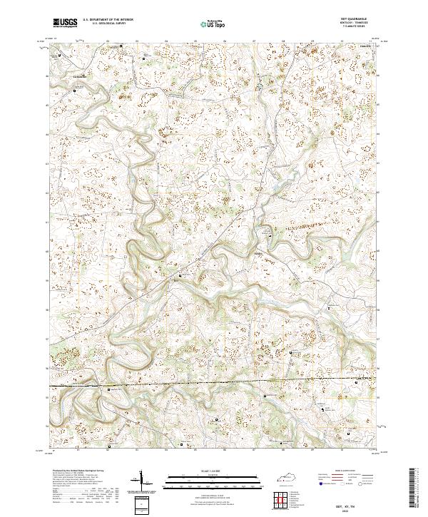
2022 Map of Dot
USGS Topo · Published 2022About this map
Dot and Schley anchor this agricultural landscape along the Kentucky Tennessee state line, where the winding course of the Red River and the South Fork Red River define the local topography. This region is marked by an exceptional density of family burial grounds and small community graveyards, reflecting a deep-seated genealogy of the borderlands. Notable sites include the James Riley Graveyard near Lickskillet and the Christian Orndorff Cem situated near the river bends.
Find a feature on this map
85 named features on this map. Tap any name to fly to it.
Don’t see what you’re looking for? This feature index may not catch every label — zoom into the map to look around manually.
Map Details
Editions of this 2022 Dot Map
This is the sole edition of this map. No revisions or reprints were ever made.
Other maps of this area

1950 · Allensville
USGS Topo · 1:24,000

1950 · Olmstead
USGS Topo · 1:24,000

1951 · Olmstead
USGS Topo · 1:24,000

1951 · Adairville
USGS Topo · 1:24,000

1951 · Dot
USGS Topo · 1:24,000

1952 · Russellville
USGS Topo · 1:24,000

1952 · Springfield North
USGS Topo · 1:24,000

1952 · Youngville
USGS Topo · 1:24,000

1952 · Dennis
USGS Topo · 1:24,000

1956 · Nashville
USGS Topo · 1:250,000