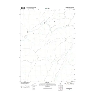
2012 Map of Doty Mountain
USGS Topo · Published 2012About this map
Doty Mountain rises as a central landmark in this high-desert landscape of Carbon County, where a network of ephemeral drainages and intermittent streams carves through the terrain. The map documents a sparsely populated area defined by isolated outposts such as Baur Ranch and the Olson Cabin. The drainage system is particularly intricate, featuring named watercourses like Muddy Cr, Antelope Cr, and the descriptively named Soap Hole Wash. These washes and draws, including Chicken Springs Wash and Cy Draw, dictate the movement and settlement patterns in this arid region. Significant topographical elevations like Baldy Butte and China Butte provide navigational markers across a landscape primarily accessed by four-wheel-drive trails and local roads, illustrating the area's continued use for ranching and resource management in the early 21st century.
Find a feature on this map
13 named features on this map. Tap any name to fly to it.
Don’t see what you’re looking for? This feature index may not catch every label — zoom into the map to look around manually.
Map Details
Editions of this 2012 Doty Mountain Map
This is the sole edition of this map. No revisions or reprints were ever made.
Other maps of this area

1954 · Rawlins
USGS Topo · 1:250,000

1957 · Doty Mountain
USGS Topo · 1:62,500

1958 · Rawlins
USGS Topo · 1:250,000

1962 · Rawlins
USGS Topo · 1:250,000

1966 · Seaverson Reservoir
USGS Topo · 1:24,000

1966 · High Point
USGS Topo · 1:24,000

1966 · Fillmore Ranch
USGS Topo · 1:24,000

1967 · Rawlins
USGS Topo · 1:250,000

1970 · Mexican Flats
USGS Topo · 1:24,000

1970 · Duck Lake
USGS Topo · 1:24,000