
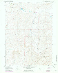
1966 Map of Seaverson Reservoir
USGS Topo · Published 1969About this map
The Continental Divide winds through this high-country landscape in Carbon County, defining the hydrologic split of the region. In the mid-1960s, this area remained characterized by its rugged drainages and industrial potential, with mining activity evident at the Cherokee Mine No 2 and a scattered Prospect or Drill Hole. Water management is central to the terrain, anchored by the Seaverson Reservoir and various seasonal flows including Fillmore Creek and Bad Water Creek. These names, along with features like Coal Bank Gulch and Holler Draw, reflect a landscape shaped by both geological necessity and the practical needs of ranching or extraction. A singular Pipeline cuts across the sections, indicating the modern infrastructure beginning to overlay these older grazing and mineral lands.
Find a feature on this map
14 named features on this map. Tap any name to fly to it.
Don’t see what you’re looking for? This feature index may not catch every label — zoom into the map to look around manually.
Map Details
Editions of this 1966 Seaverson Reservoir Map
2 editions found
Other maps of this area

1954 · Rawlins
USGS Topo · 1:250,000

1957 · Doty Mountain
USGS Topo · 1:62,500

1958 · Rawlins
USGS Topo · 1:250,000

1962 · Rawlins
USGS Topo · 1:250,000

1966 · Creston Junction
USGS Topo · 1:24,000

1966 · Riner
USGS Topo · 1:24,000

1966 · Creston
USGS Topo · 1:24,000

1966 · High Point
USGS Topo · 1:24,000

1966 · Fillmore Ranch
USGS Topo · 1:24,000

1967 · Rawlins
USGS Topo · 1:250,000