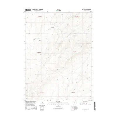
2015 Map of Doty Mountain
USGS Topo · Published 2015About this map
Doty Mtn rises above a landscape defined by intermittent watercourses and high desert terrain in this section of Carbon County. The drainage network is particularly detailed, showing the convergence of Muddy Cr with various draws and washes such as Soap Hole Wash and Holler Draw. These features suggest a topography of erosion and seasonal flow, characteristic of the Wyoming interior. Named high points like China Butte and Baldy Butte provide navigational markers across the township and range divisions, while Chicken Springs Wash points to the importance of water sources in this arid environment. The map records a sparsely developed area, emphasizing natural landmarks and the legal grid of the Public Land Survey System rather than human settlements.
Find a feature on this map
17 named features on this map. Tap any name to fly to it.
Don’t see what you’re looking for? This feature index may not catch every label — zoom into the map to look around manually.
Map Details
Editions of this 2015 Doty Mountain Map
This is the sole edition of this map. No revisions or reprints were ever made.
Other maps of this area

1954 · Rawlins
USGS Topo · 1:250,000

1957 · Doty Mountain
USGS Topo · 1:62,500

1958 · Rawlins
USGS Topo · 1:250,000

1962 · Rawlins
USGS Topo · 1:250,000

1966 · Seaverson Reservoir
USGS Topo · 1:24,000

1966 · High Point
USGS Topo · 1:24,000

1966 · Fillmore Ranch
USGS Topo · 1:24,000

1967 · Rawlins
USGS Topo · 1:250,000

1970 · Mexican Flats
USGS Topo · 1:24,000

1970 · Duck Lake
USGS Topo · 1:24,000