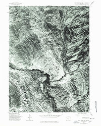
1975 Map of Doty Mountain SW
USGS Topo · Published 1978About this map
Muddy Creek winds through the heart of this high-altitude Wyoming terrain, as seen in an orthophotomap derived from aerial photography taken in late 1975. The imagery reveals a landscape of complex drainage patterns and eroded badlands, where the sinuous channel of the creek dominates the central valley. To the south, Wild Cow Creek merges with the main drainage system, showcasing the characteristic vegetation and alluvial deposits of the Carbon County desert. This 1970s record provides a clear view of the natural watercourses and cattle-country landforms before modern alterations, serving as a precise visual reference for the region's physical geography and water history.
Find a feature on this map
2 named features on this map. Tap any name to fly to it.
Don’t see what you’re looking for? This feature index may not catch every label — zoom into the map to look around manually.
Map Details
Editions of this 1975 Doty Mountain SW Map
This is the sole edition of this map. No revisions or reprints were ever made.
Other maps of this area

1954 · Rawlins
USGS Topo · 1:250,000

1957 · Baggs
USGS Topo · 1:62,500

1957 · Doty Mountain
USGS Topo · 1:62,500

1958 · Rawlins
USGS Topo · 1:250,000

1962 · Rawlins
USGS Topo · 1:250,000

1967 · Rawlins
USGS Topo · 1:250,000

1970 · Mexican Flats
USGS Topo · 1:24,000
1970 · Flat Top Mountain
USGS Topo · 1:24,000

1970 · Duck Lake
USGS Topo · 1:24,000
1975 · Baggs NW
USGS Topo · 1:24,000