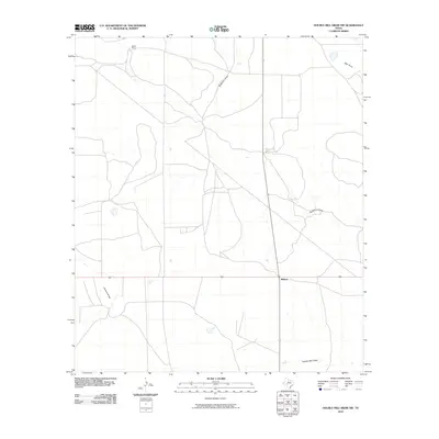
2010 Map of Double Mill Draw NW
USGS Topo · Published 2010About this map
Midway serves as a central point of reference in this arid Crockett County landscape, where the topography is defined primarily by its drainage patterns. The network of seasonal watercourses includes Buckhorn Draw, Johnson Draw, and Salt Draw, which dictate the placement of roads and property boundaries. North of the main settlement area, Bissett Ranch represents the expansive landholdings characteristic of this region's ranching economy. The map illustrates a sparse but functional infrastructure designed around the natural contours of the land, particularly near Double Mill Draw. This documentation provides a clear view of West Texas land use and water management during the early 21st century, showing how ranchers and local residents navigated a terrain where named draws provided the primary geographic orientation.
Find a feature on this map
6 named features on this map. Tap any name to fly to it.
Don’t see what you’re looking for? This feature index may not catch every label — zoom into the map to look around manually.
Map Details
Editions of this 2010 Double Mill Draw NW Map
This is the sole edition of this map. No revisions or reprints were ever made.
Other maps of this area

1920 · Big Lake
USGS Topo · 1:62,500

1920 · Barnhart
USGS Topo · 1:62,500

1922 · Big Lake
USGS Topo · 1:62,500

1922 · Barnhart
USGS Topo · 1:62,500

1954 · Sonora
USGS Topo · 1:250,000

1954 · San Angelo
USGS Topo · 1:250,000

1958 · Sonora
USGS Topo · 1:250,000

1958 · San Angelo
USGS Topo · 1:250,000

1965 · San Angelo
USGS Topo · 1:250,000

1967 · Double Mill Draw SE
USGS Topo · 1:24,000