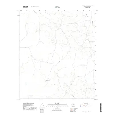
2019 Map of Double Mill Draw SE
USGS Topo · Published 2019About this map
Turkey Roost Draw and the surrounding high plains of Crockett County define this West Texas landscape as it appeared in the late 2010s. The terrain is characterized by a network of ephemeral watercourses, including Buckhorn Draw and Devils River Draw in the northeastern reaches, which channel seasonal runoff through the limestone-inflected topography. This area is sparsely settled, with the footprint of human activity primarily represented by a grid of county roads that service the regional ranching economy. Primary transit through this corner of the county is facilitated by Co Rd 109 and Taylor Rd, which intersect to connect dispersed property holdings. Other local routes like Co Rd 208 and Co Rd 108 provide access to the various draws and plateaus, illustrating the modern infrastructure required to navigate this portion of the Edwards Plateau.
Find a feature on this map
8 named features on this map. Tap any name to fly to it.
Don’t see what you’re looking for? This feature index may not catch every label — zoom into the map to look around manually.
Map Details
Editions of this 2019 Double Mill Draw SE Map
This is the sole edition of this map. No revisions or reprints were ever made.
Other maps of this area

1954 · Sonora
USGS Topo · 1:250,000

1958 · Sonora
USGS Topo · 1:250,000

1964 · Oglesby Ranch
USGS Topo · 1:24,000

1964 · Bailey Draw
USGS Topo · 1:24,000

1967 · Nolen Draw
USGS Topo · 1:24,000

1967 · Ozona
USGS Topo · 1:24,000

1967 · Double Mill Draw SE
USGS Topo · 1:24,000

1967 · Indio Hill
USGS Topo · 1:24,000

1967 · Double Mill Draw NW
USGS Topo · 1:24,000

1967 · Crockett Heights
USGS Topo · 1:24,000