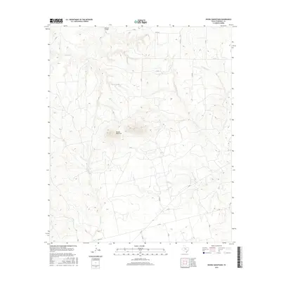
2016 Map of Double Mountains
USGS Topo · Published 2016About this map
Double Mountains rise prominently above the surrounding plains of Stonewall County, serving as a primary navigational landmark for this region of West Texas. The landscape is deeply incised by a complex drainage network, characterized by the convergence of the E Fork Salt Cr and W Fork Salt Cr into Salt Cr. To the northwest, Wildcat Canyon and the evocatively named Stinking Cr cut through the high ground, illustrating the erosive forces that shaped the Rolling Plains.
Find a feature on this map
25 named features on this map. Tap any name to fly to it.
Don’t see what you’re looking for? This feature index may not catch every label — zoom into the map to look around manually.
Map Details
Editions of this 2016 Double Mountains Map
This is the sole edition of this map. No revisions or reprints were ever made.
Other maps of this area

1893 · Roby
USGS Topo · 1:125,000

1926 · Snyder 1-a
USGS Topo · 1:48,000

1926 · Roby 2-b
USGS Topo · 1:48,000

1931 · Rotan
USGS Topo · 1:62,500

1932 · Camp Springs
USGS Topo · 1:62,500

1954 · Lubbock
USGS Topo · 1:250,000

1954 · Big Spring
USGS Topo · 1:250,000

1958 · Big Spring
USGS Topo · 1:250,000

1968 · Double Mountains
USGS Topo · 1:24,000
1968 · Coon Hollow
USGS Topo · 1:24,000