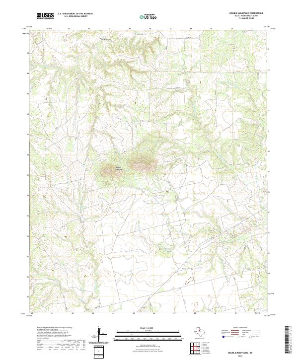
2022 Map of Double Mountains
USGS Topo · Published 2022About this map
Double Mountains rise as the most prominent topographic landmark in this section of Stonewall County, dominating the landscape south of Wildcat Canyon. The map reveals a complex drainage network that defines the region, where numerous named seasonal and permanent streams such as Stinking Creek and Nicholson Creek dissect the terrain. To the east, the headwaters of the Brazos River system begin to take shape with the convergence of West Fork Salt Creek, East Fork Salt Creek, and Salt Creek. This modern survey by the U.S. Geological Survey documents a remote landscape characterized by ranching roads and farm-to-market infrastructure, specifically FM 610, which cuts across the southern portion of the quadrangle. The lack of concentrated settlements highlights the area's continued use for large-scale land operations and natural drainage management.
Find a feature on this map
28 named features on this map. Tap any name to fly to it.
Don’t see what you’re looking for? This feature index may not catch every label — zoom into the map to look around manually.
Map Details
Editions of this 2022 Double Mountains Map
This is the sole edition of this map. No revisions or reprints were ever made.
Other maps of this area

1893 · Roby
USGS Topo · 1:125,000

1926 · Snyder 1-a
USGS Topo · 1:48,000

1926 · Roby 2-b
USGS Topo · 1:48,000

1931 · Rotan
USGS Topo · 1:62,500

1932 · Camp Springs
USGS Topo · 1:62,500

1954 · Lubbock
USGS Topo · 1:250,000

1954 · Big Spring
USGS Topo · 1:250,000

1958 · Big Spring
USGS Topo · 1:250,000

1968 · Double Mountains
USGS Topo · 1:24,000
1968 · Coon Hollow
USGS Topo · 1:24,000