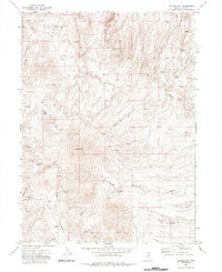
1971 Map of Double Mtn
USGS Topo · Published 1985About this map
Double Mtn rises as the central topographical anchor for this Elko County landscape, defining a network of drainages that supported early ranching and travel in northeastern Nevada. During the early 1970s, this area was characterized by a reliance on widely dispersed water sources, as seen in the numerous named springs like Skull Spring and Wagon Box Spring. The presence of the Brown House near Beaver Creek suggests a focal point for local activity amidst the vast system of unimproved routes.
Find a feature on this map
24 named features on this map. Tap any name to fly to it.
Don’t see what you’re looking for? This feature index may not catch every label — zoom into the map to look around manually.
Map Details
Editions of this 1971 Double Mtn Map
2 editions found
Other maps of this area

1935 · Charleston
USGS Topo · 1:48,000

1942 · Mt. Velma
USGS Topo · 1:62,500

1955 · Wells
USGS Topo · 1:250,000

1956 · Wild Horse
USGS Topo · 1:62,500

1958 · Wells
USGS Topo · 1:250,000

1961 · Wells
USGS Topo · 1:250,000

1971 · Double Mtn
USGS Topo · 1:24,000

1971 · Devils Armchair
USGS Topo · 1:24,000

1971 · North Fork
USGS Topo · 1:24,000

1971 · Double Mtn SE
USGS Topo · 1:24,000