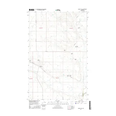
2017 Map of Double S Hill
USGS Topo · Published 2017About this map
Milk River meanders across this northern Montana landscape, meeting Frenchman Creek near the border of Phillips and Valley counties. The terrain is defined by a series of distinct coulees and hills that speak to the ranching history of the region, including Turkey Track Hill and Double S Hill. Water sources are vital in this arid environment, evidenced by named features such as Wrights Spring, Negro Jakes Spring, and Strouble Spring. The road network is sparse, centered on routes like Milk River Rd and Frenchman Rd, which connect isolated features like Shearing Plant Coulee. The presence of Bjornberg Brg across the river in the southeast corner provides a specific point of interest for those tracing historical access points and river crossings in this part of the plains.
Find a feature on this map
27 named features on this map. Tap any name to fly to it.
Don’t see what you’re looking for? This feature index may not catch every label — zoom into the map to look around manually.
Map Details
Editions of this 2017 Double S Hill Map
This is the sole edition of this map. No revisions or reprints were ever made.
Other maps of this area

1905 · Saco Special
USGS Topo · 1:62,500

1906 · Hinsdale Special Map
USGS Topo · 1:62,500

1954 · Glasgow
USGS Topo · 1:250,000

1957 · Glasgow
USGS Topo · 1:250,000

1958 · Glasgow
USGS Topo · 1:250,000

1984 · Cole
USGS Topo · 1:24,000

1984 · Bjornberg Bridge
USGS Topo · 1:24,000
1984 · Robinson Ranch
USGS Topo · 1:24,000

1984 · Double S Hill
USGS Topo · 1:24,000

1984 · Forks
USGS Topo · 1:24,000