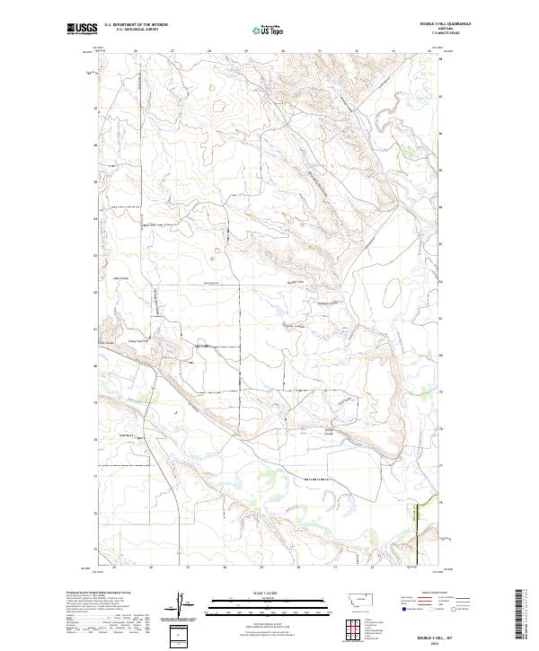
2024 Map of Double S Hill
USGS Topo · Published 2024About this map
The Milk River winds through this northern Montana landscape, meeting Frenchman Creek in a region defined by its complex drainage network and isolated landmarks. The terrain is marked by distinctive elevations such as Double S Hill and Turkey Track Hill, which overlook a series of deep coulees including Prestige Coulee and Burnt Sheep Shed Coulee. A network of water sources, including Negro Jakes Spring, Wrights Spring, and Spiller Spring, highlights the importance of reliable water in this arid environment. Transportation through the area relies on historic routes like Turkey Track Rd and Frenchman Rd, which traverse the border of Phillips and Valley Counties. The map provides a detailed view of the natural landforms and the named ravines that characterize this portion of the northern plains.
Find a feature on this map
25 named features on this map. Tap any name to fly to it.
Don’t see what you’re looking for? This feature index may not catch every label — zoom into the map to look around manually.
Map Details
Editions of this 2024 Double S Hill Map
This is the sole edition of this map. No revisions or reprints were ever made.
Other maps of this area

1905 · Saco Special
USGS Topo · 1:62,500

1906 · Hinsdale Special Map
USGS Topo · 1:62,500

1954 · Glasgow
USGS Topo · 1:250,000

1957 · Glasgow
USGS Topo · 1:250,000

1958 · Glasgow
USGS Topo · 1:250,000

1984 · Cole
USGS Topo · 1:24,000

1984 · Bjornberg Bridge
USGS Topo · 1:24,000
1984 · Robinson Ranch
USGS Topo · 1:24,000

1984 · Double S Hill
USGS Topo · 1:24,000

1984 · Forks
USGS Topo · 1:24,000