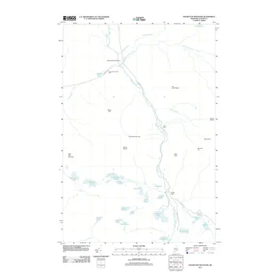
2011 Map of Doubletop Mountain
USGS Topo · Published 2011About this map
Baxter State Park dominates this Maine interior, where the waters of Nesowadnehunk Stream flow south through a high-elevation drainage. The landscape is defined by its glacial hydrology, featuring a dense concentration of water bodies such as Kidney Pond, Daicey Pond, and the interconnected Slaughter and Polly ponds. Small human clearings like Nesowadnehunk Field and the Nesowadnehunk Field Camp provide localized points of access along the Grand Lake Rd corridor. Significant topographical features including Doubletop Mountain, Mount O-J-I, and the West Peak overlook the stream valley, while smaller landmarks like Ledge Falls and Slide Dam mark historical or natural transitions in the water's path. This survey documents the area's intricate network of brooks and ponds just before the turn of the decade, anchoring a wilderness geography that remains largely defined by its granite peaks and remote fields.
Find a feature on this map
44 named features on this map. Tap any name to fly to it.
Don’t see what you’re looking for? This feature index may not catch every label — zoom into the map to look around manually.
Map Details
Editions of this 2011 Doubletop Mountain Map
This is the sole edition of this map. No revisions or reprints were ever made.
Other maps of this area

1927 · Katahdin
USGS Topo · 1:48,000

1930 · Katahdin
USGS Topo · 1:62,500

1949 · Katahdin
USGS Topo · 1:62,500

1953 · Telos Lake
USGS Topo · 1:62,500

1954 · Harrington Lake
USGS Topo · 1:62,500

1954 · Presque Isle
USGS Topo · 1:250,000

1954 · Millinocket
USGS Topo · 1:250,000

1955 · Traveler Mountain
USGS Topo · 1:62,500

1957 · Telos Lake
USGS Topo · 1:62,500

1958 · Presque Isle
USGS Topo · 1:250,000